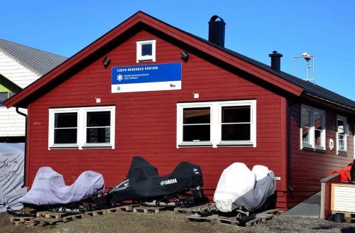
Czech Arctic Research Station of Josef Svoboda
Address
Czech Arctic Research StationVei 401-42
9170 Longyearbyen
Svalbard, Norway
Station manager
Jan PecharContact Station
https://www.prf.jcu.cz/enStation Features
Opening year: 2007 Status: OpenFacilities
Station name and owner
The Czech Arctic Research Station of Josef Svoboda is owned by the University of South Bohemia in the Czech Republic.
Location
The Czech research facilities in Svalbard consist of a research base in Longyearbyen called “Payer’s house” and a field camp in the central part of Svalbard in Billefjorden (called Nostoc houses). Field activities are mainly taking place in Petuniabukta in the northernmost part of Billefjorden.
Climate data
Grey colours are WMO Climate Normals including maximum and minimum values. Blue colours are individual years.
Climate data for the stations where extracted via Copernicus Climate Data Store, from the global gridded reanalysis product:
ERA5 monthly averaged data on single levels from 1940 to present.
Description and source code: Roemer J.K. 2023. https://doi.org/10.5281/zenodo.10214922
Data Source: Hersbach et al. 2023. Copernicus Climate Change Service (C3S) Climate Data Store (CDS), https://doi.org/10.24381/cds.f17050d7
Biodiversity and natural environment
The Czech Arctic Research Station of Josef Svoboda is situated in the High Arctic. The mean annual temperature is -6 °C, and the mean annual precipitation is 150-200 mm. Petuniabukta, where the field camp is located, is in the central part of the Svalbard archipelago, which is more continental and drier than the western part. There is a steep elevation gradient in the area (the highest mountains reach 1000 m a.s.l.). Various habitats can be accessed within walking distance in the study area, i.e. sandy beaches, waterlogged tundra, seepages, dry tundra, bird cliffs, lakes, snow-melt and glacial streams, glaciers, etc. Rich wildlife, incl. gulls, kittiwakes, terns, barnacle geese, eiders, reindeer, arctic foxes, and polar bears are present as well.
History and facilities
The station in Longyaerbyen was established in 2013. Accommodation is available for up to 16 people, and the station further includes laboratories for standard laboratory work. During the summer season, a field camp located ca. 6 km north of the settlement, Pyramiden, is used. The huts can accommodate up to 12 persons and are equipped with a small laboratory, kitchen, and shared bedrooms. Communication is ensured with VHF radios and satellite phones. Three zodiacs are used for transportation in the Billefjorden area. From 2015 a 15 m motor-sailer (for up to 10 persons, four overnight) will be available.
General research and databases
Research mainly focuses on biodiversity and ecosystem dynamics. Relatively long research records on plant ecology, phycology, parasitology, and bioclimatology exist. Today, studies on geomorphology and hydrology are developing in the area. Regular meteorological measurements were established in 2007.
Station Monitoring
Human dimension
The station is located in Longyearbyen with a predominantly Norwegian population of c. 2100 inhabitants. Historically, the population was employed in fishery, hunting, and whaling, later in the coal mining industry. Today, tourism is becoming the main business. The field camp is near the old mining town of Pyramiden, an area with strong Russian influence.
Access
There are regular commercial flights to Longyearbyen (3 hours from Oslo). To reach the field camp, local cruising companies organise tourist trips to Pyramiden approximately 5 km from the field camp. It usually takes 5-6 hours to reach Pyramiden from Longyearbyen. There is also the possibility of renting a boat in Longyearbyen from a private company. Reaching the station in a rubber boat requires good weather conditions and calm sea. Distance from Logyearbyen is c. 60 km by boat.