Address

Summit Station Science Coordination Office

Station manager

Sam Dorsi
E-mail: sam@polarfield.com

Contact Station

E-mail: sco@geo-summit.org

www.geo-summit.org

Station Features

Opening year: 1989 Status: Open
  • Type of station: Station
  • Operational period – year-round or Month A to Month B: Year-round
  • Name of station owner: US National Science Foundation (NSF)
  • Type of owner: Government
  • Name of managing institution: Battelle Arctic Research Operations (ARO)
  • Managing Institution Country: United States
  • Station owner country: United States
  • Partner institution: No
  • Station latitude: 72,58054944
  • Station longitude: -38,45867825
  • Country (station location): Greenland
  • Altitude of station: 3210 m a.s.l
  • Min. altitude within study area: 3210 m a.s.l
  • Max. altitude within study area: 3210 m a.s.l
  • Nearest town/settlement: Ilulissat
  • Distance to nearest town/settlement: 593 km
  • Number of residents in nearest town: 4500
  • Distance to nearest public transport facility (Airport, Ferry terminal, Train station, Bus station): 0 km
  • Distance to nearest research station: 345 km
  • Maps available at station: Aerial image, satellite image, Google Earth
  • Type of surface facility is built on: Ice
  • Climate zone: High Arctic
  • Period of measurments for climate data below [year to year]: 2003-present (NOAA baseline measurements)
  • Mean annual temperature: -31 °C
  • Mean temperature in February: -42 °C
  • Mean temperature in July: -12 °C
  • Min. Temp. (absolute): -67 °C
  • Max. Temp. (absolute): 1 °C
  • Precipitation type: Snow
  • Sea ice break up: January
  • Lake ice break up: January
  • River ice break up: January
  • Dominant wind direction: South
  • Mean annual wind speed: 4,1 m/s
  • Date of maximum wind speed: Monday, 14 March 2022
  • Maximum wind speed (absolute): 37 m/s
  • Landscape features Plateaus
  • Permafrost zone Continuous
  • Snow and ice on land Ice Caps
  • Vegetation zone Polar desert/Semi-desert

Facilities

  • Area under roof: 758 m²
  • Max. number of visitors at a time : 50
  • Showers: Yes
  • Laundry facilities: Yes
  • Power supply – period (from ‘hour’ to ‘hour’ or 24 hours): 24 hours
  • Power sources at station Diesel/oil/gas, Other
  • Logistics area: 493 m²
  • Workshops Metal, Wood
  • Means of transportation to/from station Chartered plane/helicopter
  • Air transport landing facilities at station Airstrip
  • Airstrip (Length × Width) : 5120 m × 61 m. Groomed April-August
  • Airstrip surface : Snow/Ice
  • Transport on land - at station Snowmobile, Other
  • Number of staff peak season/summer: 45
  • Number of staff off season/winter: 5
  • Staff able to assist (fieldwork): Yes - at a cost
  • Staff able to assist (workshops): Yes - at a cost
  • Compulsory safety equipment Other, VHF, Satellite phone
  • Recommended safety equipment Other
  • Field power supply available at station: Yes
  • Laboratory area: 60 m²
  • Medical facilities: Yes
  • Medical capability Medium
  • Staff with medical training/doctor In peak season
  • Distance to hospital (estimated time – hours): 1080
  • Field to station VHF, Satellite phone
  • Station to outside world Internet, Other
  • IT Infrastructure Wifi, Computers, Printer

Science

  • Transnational Access: No
  • Remote Access: No
  • INTERACT Virtual Access: No
  • Permitting issues categories
    • Permits required for access to the station
    • Permits required for studies
  • Partner institutions (involved in the operation of the station)
    • Partner institution
  • Climate
    • Snow
    • Rain
    • Hail
  • Housing and accomodation
    • Showers
    • Laundry facilities
    • A
    • B
    • C
    • D
    • E
    • F
    • G
    • H
    • I
    • J
    • K
    • L
    • M
    • N
    • O
    • Municipal grid
    • Diesel/oil/gas
    • Wood
    • Solar
    • Wind
    • Water
    • Geothermal
    • Biofuel
    • Other
  • Logistics
    • Electrical and IT technologies
    • Mechanical
    • Metal
    • Wood
    • Plexiglas
    • Other
    • Walk
    • None
    • Tracked vehicle
    • Truck
    • SUV (4x4)
    • Car
    • ATV
    • Zodiac
    • Snowmobile
    • Open boat/Dhinghy
    • Closed boat
    • Bicycles
    • Amphibie vehicle
    • Ski
    • Other
    • Snow shoes
    • KickSledges
    • Other
    • Ski
    • Snowmobile
    • Boat
    • Car
    • Tracked vehicle
    • Truck
    • SUV (4x4)
    • Bus
    • Train
    • Airstrip
    • Scheduled flight
    • Chartered plane/helicopter
    • Helipad
    • Other
    • None
    • Harbour/port
    • Warf/pier
    • Pontoon/float bridge
    • Barges
    • Beach
  • Aircraft landing facilities
    • Helipad
  • Features in the facility area
    • Permanent snowpatches
    • Mountain
    • Valley
    • Lake
    • River
    • Shoreline
    • Tree line
    • Polar deserts/semi-deserts
    • Shrub tundra
    • Gramminoid tundra
    • Forest tundra
    • Peatlands
    • Wetlands
    • Palsa mires
    • Deciduous forest
    • Evergreen forest
    • Human settlements or resource use in the area
    • Arable land
    • Other
  • Main science disciplines
    • Astronomy
    • Atmospheric sciences
    • Cryology
    • Geology
    • Hydrology
    • Limnic biology
    • Marine biology
    • Terrestrial biology
    • Human biology
    • Anthropology
    • Archaeology
    • Sociology
    • Climate change
    • Environmental science (incl. pollution)
    • Oceanography
    • Agriculture
    • Animal husbandry
    • Fisheries
    • Forestry
    • Hunting
    • Tourism
  • Workshop facilities
    • Metal workshop
    • Wood workshop
    • Plexiglas workshop
    • Staff available to assist with constructions
  • Communication
    • Telephone
    • Satellite phone
    • VHF
    • E-mail
    • Internet
    • Computer
    • Printer
    • Scanner
    • Fax
  • Meteorology
    • Air temperature
    • Air humidity
    • Air pressure
    • Wind velocity
    • Wind direction
    • Precipitation
  • Energy balance and radiation
    • Energy balance
    • Short wave incoming
    • Short wave outgoing
    • Long wave incoming
    • Long wave outgoing
    • Net radiation
    • UV-B
    • Multi-spectral
    • Cloud cover/hours of sunshine
  • Geophysics and Geodesy
    • Gravity
    • Magnetic field
    • Aurora
    • Seismic activity
  • Atmospheric composition
    • CO<sub>2</sub> concentration
    • CH<sub>4</sub> concentration
  • Energy budget
    • Net radiation
    • Sensible heat flux
    • Latent heat flux
    • Soil heat flux
  • Pollution
    • In air
    • In water
    • In soil
    • In snow/ice
    • Contaminants in species
  • Glacier characteristics
    • Glacier area
    • Topography
    • Elevation change
    • Terminus position
    • Ice velocity
    • Ice thickness
    • Debris cover
    • Surface albedo/reflexion coefficient
  • Mass balace
    • Mass balance
    • Snow water equivalent
    • Snowcover stratigraphy
    • Equilibrium Line Altitude
    • Duration of snow cover
    • Calving flux
  • Climate
    • Climate measurements
    • Energy balance
  • Particles and aerosols
    • Particles and aerosols
  • Isotope chemistry of snow, ice and water
    • Isotope chemistry of snow, ice and water
  • Socio-ecological issues (disturbance)
    • Number of visitors
    • Surface activities (e.g. removal of vegetation, organisms, soil samples, ATV traffic, manipulations)
    • Aircraft activities
    • Emissions/discharge energy consumption, spill water, waste, garbage, atmospheric emissions, etc.)
  • Landscape and environment
    • Mountains
    • Nunataks
    • Volcano/crater
    • Lava fields
    • Plateaus
    • Moraines
    • Valleys
    • Homothermic Springs
    • Lake
    • Thermokarst lake
    • River
    • Delta/estuarie
    • Fjord
    • Continuous
    • Sea
    • Discontinuous
    • Beach
    • Sporadic
    • Rocky shores
    • Pingos/ice lenses
    • Sea cliffs
    • Other (text)
    • Palsa mires
    • None
    • Ice Caps
    • Glaciers
    • Permanent snow patches
    • None
    • Tree line
    • Polar desert/Semi-desert
    • Gramminoid tundra
    • Shrub tundra
    • Forest tundra
    • Wetlands
    • Peatlands/mires
    • Salt marshes/lagoons
    • Heath
    • Grassland
    • Deciduous forest
    • Evergreen forest
    • Terrestrial carnivores
    • Alpine heath
    • Ungulates
    • Hares
    • Other (text)
    • Rodents
    • Bird colonies
    • Polar bear
    • Whales
    • Seals
    • Fish
    • Settlement
    • Fishing
    • Hunting
    • Forestry
    • Agriculture
    • Tourism
    • Animal husbandry
    • Leisure activities
  • Field equipment
    • PLB
    • VHF
    • HF
    • Satellite phone
    • Mobile phone
    • GPS
    • Weapon/rifle
    • Flare gun
    • Bearspray
    • PLB
    • First aid kit
    • Glacier rescue kit
    • VHF
    • Avalanche rescue kit
    • HF
    • Satellite phone
    • Overnight equipment
    • Other
    • Mobile phone
    • GPS
    • Weapon/rifle
    • Flare gun
    • Bearspray
    • PLB
    • First aid kit
    • VHF
    • Glacier rescue kit
    • Avalanche rescue kit
    • HF
    • Satellite phone
    • Overnight equipment
    • Other
    • Mobile phone
    • GPS
    • Weapon/rifle
    • Flare gun
    • Bearspray
    • Tent
    • First aid kit
    • Glacier rescue kit
    • Sleeping matress
    • Avalanche rescue kit
    • Sleeping bag
    • Cooking equipment and utensils
    • Overnight equipment
    • Other
    • Gas/alcohol for cooking
    • Field power supply available at station
  • Laboratory
    • Freezer < -80
    • Freezer -40 - -10
    • Fridge
    • Microscopes
    • Basic laboratory equipment
    • Advanced laboratory equipment
    • Basic chemical reagents
    • Analytical instrumentation
    • Other
    • Laboratory available in nearby town/settlement
  • Medical facilities
    • Medical facilities
    • Basic
    • Medium
    • Extensive
    • Dental
    • Surgery
    • Other
    • No
    • In peak season
    • When open
  • Communication and IT
    • Mobile phone
    • VHF
    • Satellite phone
    • Other
    • Satellite phone
    • Mobile phone
    • Internet
    • Other
    • Wireless transfer of data from field site to station
    • Wifi
    • Computers
    • Printer
    • Data storage
    • Statistical tools
    • GIS tools
    • Other

Station name and owner

Summit Station is funded by the US National Science Foundation (NSF) and operated by Battelle Arctic Research Operations (ARO) with guidance from the Science Coordination Office (SCO).

Location

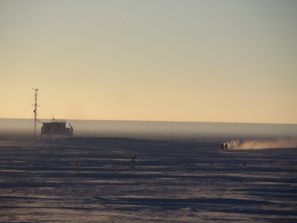
Summit Station (72°36’ N, 38°25’ W), is a research platform locat­ed near the apex of the Greenland ice sheet, at an altitude of 3210 meters. It is located within Kalaallit Nunaanni nuna eqqissisimatitaq: the Northeast Greenland National Park. As the largest national park in the world, it protects 972,000 square km of inland ice and glaciers, as well as adjoining coastal land areas.

Climate data

Grey colours are WMO Climate Normals including maximum and minimum values. Blue colours are individual years.

Climate data for the stations where extracted via Copernicus Climate Data Store, from the global gridded reanalysis product: ERA5 monthly averaged data on single levels from 1940 to present. Description and source code: Roemer J.K. 2023. https://doi.org/10.5281/zenodo.10214922 Data Source: Hersbach et al. 2023. Copernicus Climate Change Service (C3S) Climate Data Store (CDS), https://doi.org/10.24381/cds.f17050d7

Biodiversity and natural environment

Summit Station is located onthe high polar plateau of the Greenland ice sheet. The station is in the accumulation zone of the ice sheet; it experiences approximately 0.7 meters of snow accumulation per year. The effective pressure altitude ranges from 11,000 to 13,000 feet. Temperatures range from -88 F in the winter to approximately 32 F in the summer. Wind speeds in the summer are generally mild, but can exceed 40 knots during storm events. In the wintertime, sustained wind speeds have been recorded in excess of 70 knots. The nearest exposed land is approximately 400 km away. Summit Station offers access to a high-elevation, high-latitude, low-water-vapor, and year-round-supported location. This facilitates access to otherwise challenging-to-measure components of the earth system. The facility is currently the highest elevation research station located north of the Arctic Circle.

History and facilities

Summit Station was established for the collection of the Greenland Ice Sheet Project 2 (GISP2) ice core. At that time, seasonal campaigns were undertaken to measure atmospheric com­ponents, in order to improve the interpretation of the ice core records. Recognition of the value of observations at the site led to intensive measurement campaigns, and eventually continuous year-round staffed research activities since 2003. Summit Station has become a world-class Arctic observatory as part of the Arctic Observing Network (AON) and the International Arctic Systems for Observing the Atmosphere (IASOA) network. The station facilities consist of a combination of permanent year-round science and operations structures, as well as seasonal structures to accommodate summertime research campaigns and maintenance. The station serves a seasonal population of up to 45 staff and researchers during the months of April - September, and a staff of 4-6 staff during October - March.

General research and databases

A wide variety of research projects have been conducted at Sum­mit Station since its establishment in 1989. Summit Station has developed into an interdisciplinary research hub supporting a wide range of scientific research on a year-round basis. These include meteorology, glaciology, atmospheric chemistry, astrophysics, and more. In addition to investigator-driven projects, Summit Station also supports longer-term year-round observations of key baseline variables of climate change at the site. A table of current measurements, publications and contacts by which to access Summit Station datasets can be found at the GEO­Summit website: www.geo-summit.org

Station Monitoring

Human dimension

The nearest local community to Summit Station is Ilulissat at a distance of 593 km. The Summit Station research community collaborates with researchers in Greenland, Denmark, and across the world.

Access

Research access to Summit Station is managed by the US National Science Foundation. Information on requesting access and logistical support is available at the Battelle Arctic Gateway: https://battellearcticgateway.org/program-information Researchers must also meet the science permitting requirements of the Government of Greenland. Physical access for researchers and cargo is provided via Kangerlussuaq, Greenland, on Hercules LC-130 aircraft operated by the New York Air National Guard 109th Airlift Wing (NYANG-109), as well as other ski-equipped aircraft. A 4877-meter-long snow runway is groomed for summertime flight operations. The station can also be accessed via surface traverses.

Member of: