Address

Tjóðsavnið
Kúrdalsvegur 15
188 Hoyvík
Faroe Islands

Station manager

Leivur Janus Hansen
E-mail: janus@savn.fo

Contact Station

Phone: +298 340571
E-mail: savn@savn.fo

https://www.tjodsavnid.fo/nature-of-koltur/research-station

Station Features

Opening year: 2019 Status: Open
  • Type of station: Station
  • Operational period – year-round or Month A to Month B: January to December
  • Name of station owner: Faroe Islands National Museum
  • Type of owner: Government
  • Name of managing institution: Faroe Islands National Museum
  • Managing Institution Country: Faroe Islands
  • Station owner country: Faroe Islands
  • Partner institution: No
  • Station latitude: 61,98470000
  • Station longitude: -6,96430000
  • Country (station location): Faroe Islands
  • Altitude of station: 13 m a.s.l
  • Min. altitude within study area: 0 m a.s.l
  • Max. altitude within study area: 478 m a.s.l
  • Nearest town/settlement: Hestur
  • Distance to nearest town/settlement: 5 km
  • Number of residents in nearest town: 20
  • Distance to nearest public transport facility (Airport, Ferry terminal, Train station, Bus station): 0 km
  • Type of surface facility is built on: Rock
  • Climate zone: Sub-Arctic
  • Period of measurments for climate data below [year to year]: 2003 to 2007
  • Mean annual temperature: 8 °C
  • Mean temperature in February: 4,9 °C
  • Mean temperature in July: 11 °C
  • Min. Temp. (absolute) - date: Tuesday, 21 March 2006
  • Min. Temp. (absolute): -4,9 °C
  • Max. Temp. (absolute) - date: Tuesday, 10 August 2004
  • Max. Temp. (absolute): 19,3 °C
  • Precipitation type: Snow, Rain, Hail
  • Snow free period (month to month): January to December
  • Sea ice break up: January
  • Lake ice break up: January
  • River ice break up: January
  • Dominant wind direction: Southwest
  • Date of maximum wind speed: Thursday, 11 January 2007
  • Maximum wind speed (absolute): 38 m/s

Facilities

  • Number of staff peak season/summer: 5
  • Number of staff off season/winter: 1
  • Staff able to assist (fieldwork): Yes - if time allows
  • Staff able to assist (workshops): Yes - if time allows
  • Area under roof: 160 m²
  • Max. number of visitors at a time : 4
  • Showers: Yes
  • Laundry facilities: Yes
  • Power supply – period (from ‘hour’ to ‘hour’ or 24 hours): 24 hours
  • Power supply - plug type C, E, F, K
  • Power sources at station Diesel/oil/gas
  • Compulsory safety equipment Mobile phone
  • Safety equipment available at station GPS
  • Laboratory equipment Freezer -40 - -10, Fridge, Microscopes
  • Station to outside world Mobile phone, Internet
  • IT Infrastructure Wifi
  • Medical capability Basic
  • Staff with medical training/doctor No
  • Distance to hospital (estimated time – hours): 1

Science

  • Transnational Access: No
  • Remote Access: No
  • INTERACT Virtual Access: No
  • Partner institutions (involved in the operation of the station)
    • Partner institution
  • Climate
    • Snow
    • Rain
    • Hail
  • Housing and accomodation
    • Showers
    • Laundry facilities
    • A
    • B
    • C
    • D
    • E
    • F
    • G
    • H
    • I
    • J
    • K
    • L
    • M
    • N
    • O
    • Municipal grid
    • Diesel/oil/gas
    • Wood
    • Solar
    • Wind
    • Water
    • Geothermal
    • Biofuel
    • Other
  • Field equipment
    • PLB
    • VHF
    • HF
    • Satellite phone
    • Mobile phone
    • GPS
    • Weapon/rifle
    • Flare gun
    • Bearspray
    • PLB
    • First aid kit
    • Glacier rescue kit
    • VHF
    • Avalanche rescue kit
    • HF
    • Satellite phone
    • Overnight equipment
    • Other
    • Mobile phone
    • GPS
    • Weapon/rifle
    • Flare gun
    • Bearspray
    • PLB
    • First aid kit
    • Glacier rescue kit
    • VHF
    • Avalanche rescue kit
    • HF
    • Satellite phone
    • Overnight equipment
    • Other
    • Mobile phone
    • GPS
    • Weapon/rifle
    • Flare gun
    • Bearspray
    • Tent
    • First aid kit
    • Glacier rescue kit
    • Sleeping matress
    • Avalanche rescue kit
    • Sleeping bag
    • Cooking equipment and utensils
    • Overnight equipment
    • Other
    • Gas/alcohol for cooking
    • Field power supply available at station
  • Laboratory
    • Freezer < -80
    • Freezer -40 - -10
    • Fridge
    • Microscopes
    • Basic laboratory equipment
    • Advanced laboratory equipment
    • Basic chemical reagents
    • Analytical instrumentation
    • Other
    • Laboratory available in nearby town/settlement
  • Communication and IT
    • Mobile phone
    • VHF
    • Satellite phone
    • Other
    • Satellite phone
    • Mobile phone
    • Internet
    • Other
    • Wireless transfer of data from field site to station
    • Wifi
    • Computers
    • Printer
    • Data storage
    • Statistical tools
    • GIS tools
    • Other
  • Medical facilities
    • Medical facilities
    • Basic
    • Medium
    • Extensive
    • Dental
    • Surgery
    • Other
    • No
    • In peak season
    • When open
  • Arthropods
    • Abundance
    • Emergence phenology
    • Insect herbivory
    • Species list (community composition)
  • Birds
    • Abundance
    • Distribution
    • Phenology
    • Breeding birds
    • Nest initiation phenology
    • Nest predation rates
    • Species list (community composition)

Station name and owner

Koltur Research Station is managed by Faroe Islands National Museum.

Location

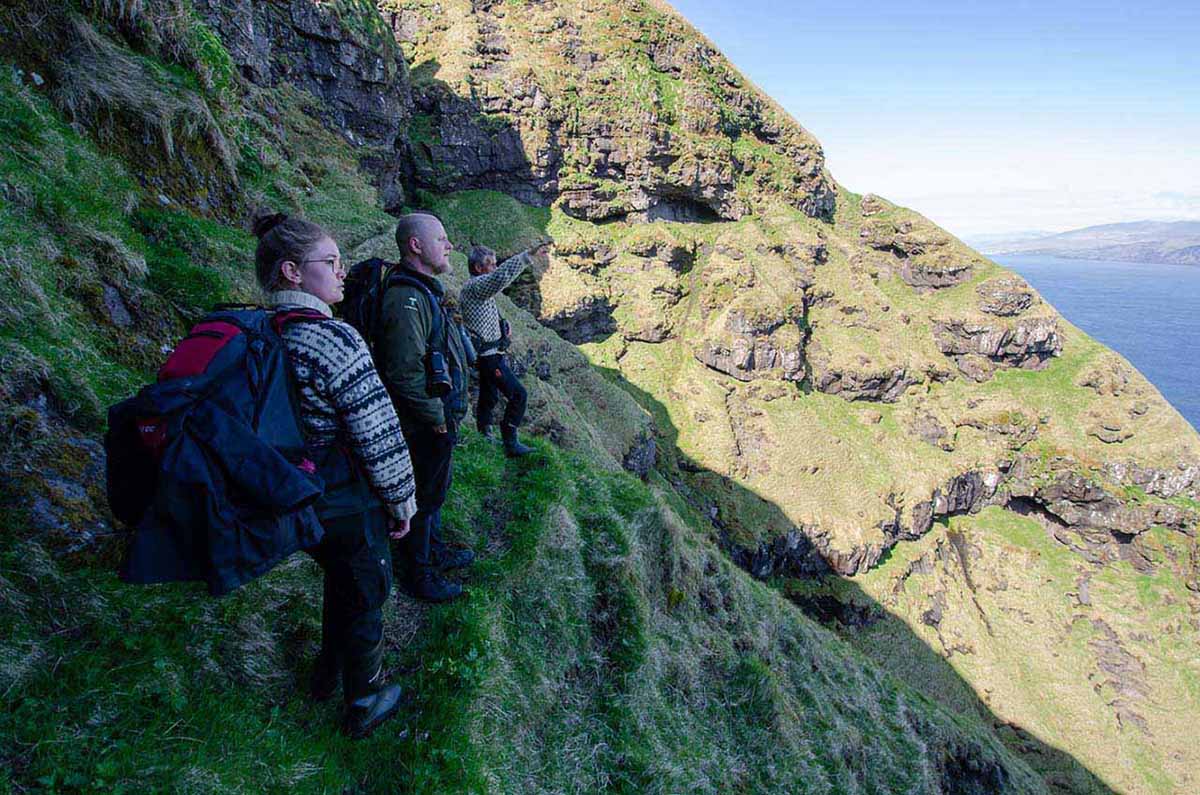
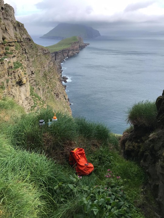
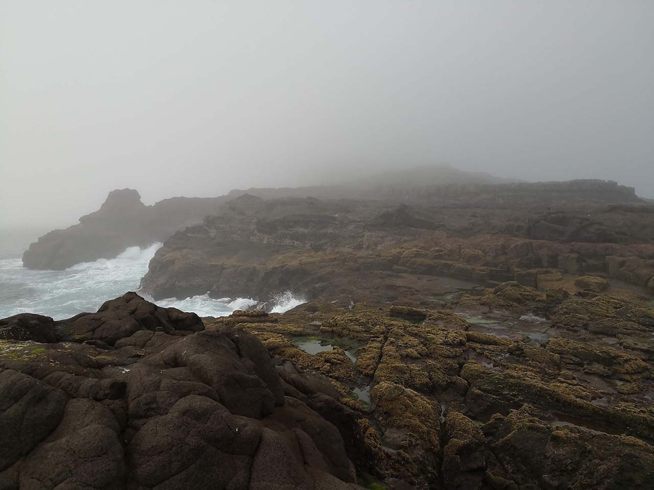
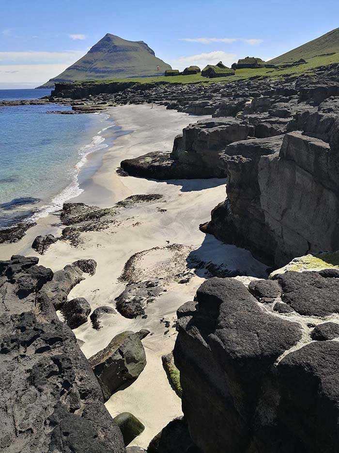
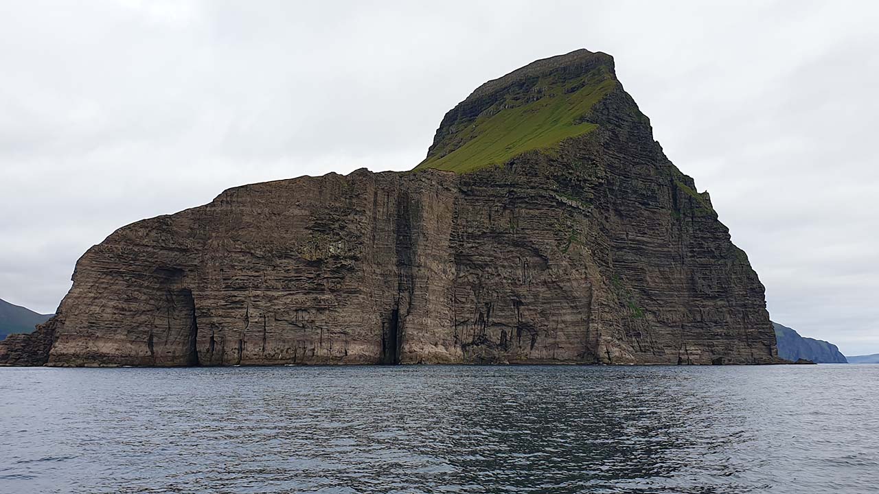
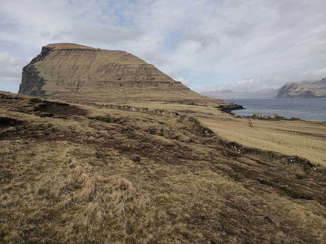
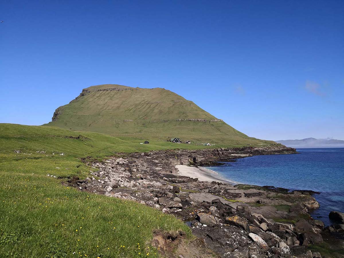
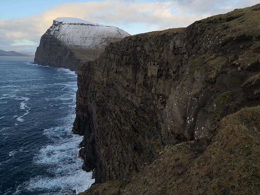
The station is located on a 2.5 km2 island which reaches 477m a.s.l. and has typical sheep-grazed grassy slopes, exposed rocky shores, sea-bird cliffs and small streams. The island is under the auspices of the National Museum and is partly protected. It is situated 3.5 km from the island of Streymoy and the western side is exposed to the predominant south-westerly winds and waves.

Climate data

Grey colours are WMO Climate Normals including maximum and minimum values. Blue colours are individual years.

Climate data for the stations where extracted via Copernicus Climate Data Store, from the global gridded reanalysis product: ERA5 monthly averaged data on single levels from 1940 to present. Description and source code: Roemer J.K. 2023. https://doi.org/10.5281/zenodo.10214922 Data Source: Hersbach et al. 2023. Copernicus Climate Change Service (C3S) Climate Data Store (CDS), https://doi.org/10.24381/cds.f17050d7

Biodiversity and natural environment

The Faroes have an oceanic sub-arctic climate and are characterised by a high relief. There are no native terrestrial mammals, no amphibians or snakes, and several groups of insects are not present either such as mayflies and dragonflies. The island of Koltur has relatively few non-native species. There are breeding populations of Arctic puffin, Manx shearwater and European storm-petrel.

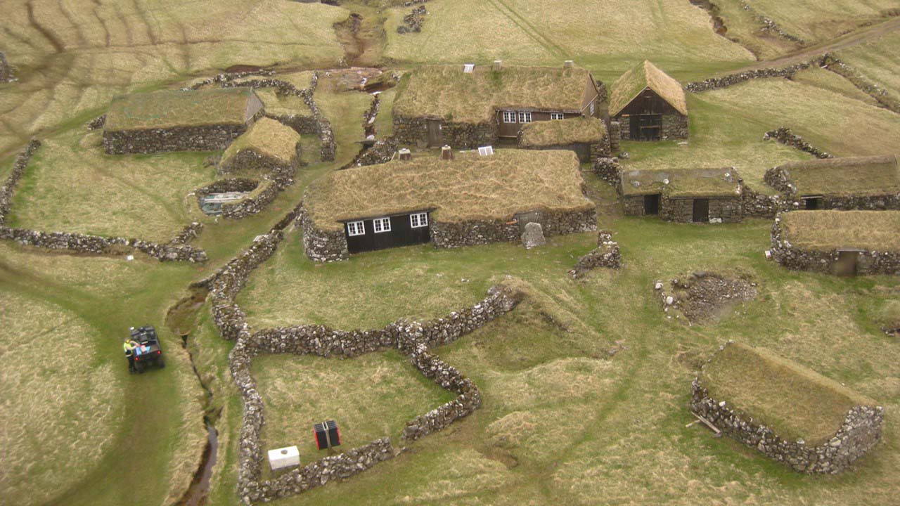
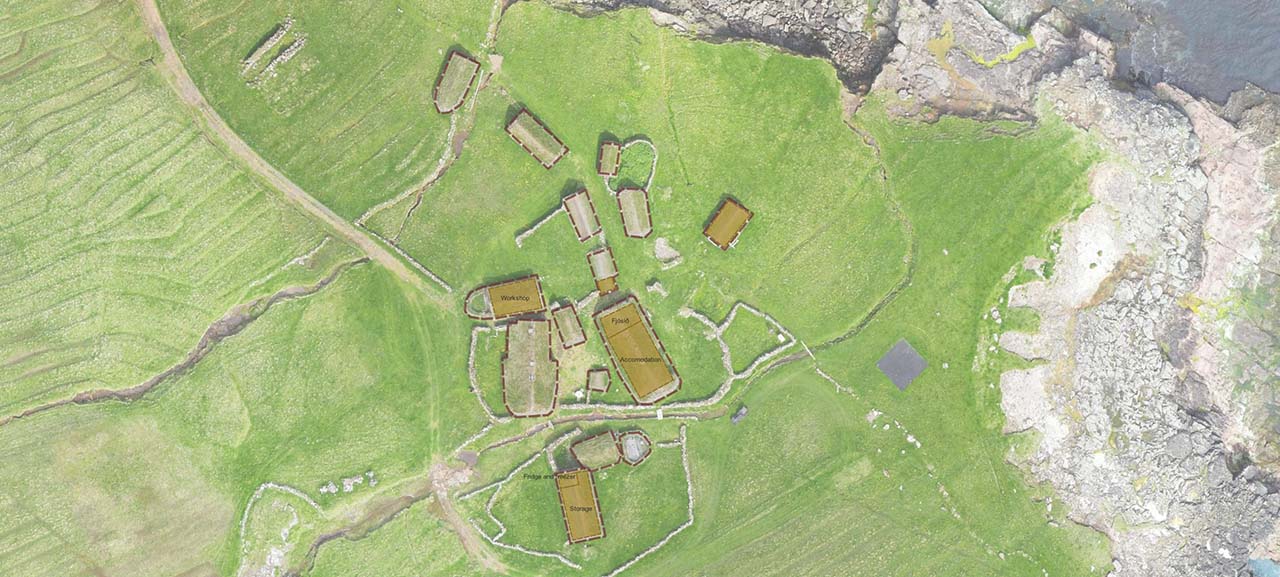
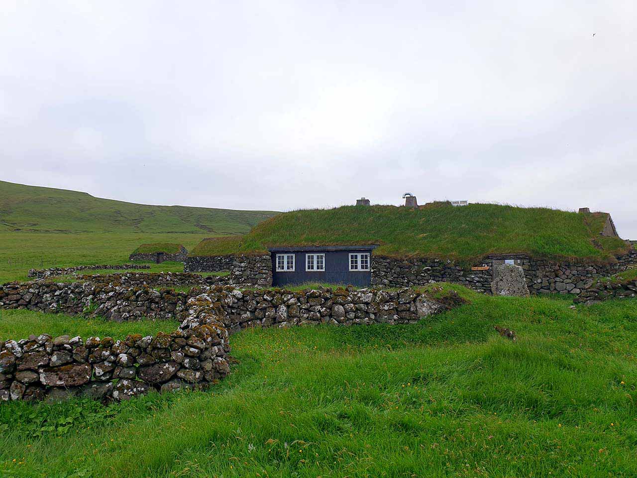
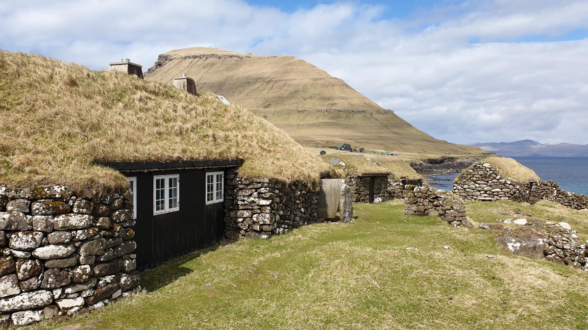
History and facilities

The Research Station is part of several reconstructed old stone houses surrounded by old barley fields. There are several buildings and outhouses which are being used as part of the station. The National Museum has used it for nature studies since 2019. The whole of the island officially became part of the Museum in 2014. The research station can have 4 people at the same time which can have use of all basic amenities, such as kitchen, freezer and shower.

General research and databases
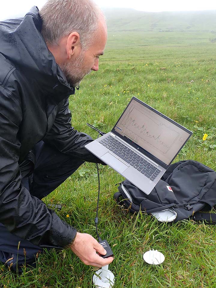
Main research now is a baseline study of the biodiversity of the island. Invertebrates are being sampled using methods such as pit-fall traps, Malaise trap, net-sweeping and Surber sampling in freshwater. Birds and vegetation are being recorded. Several temperature loggers are placed around the island. There is no dedicated database.

Station Monitoring

Human dimension

There are two settlements, Norði í Gerði og Heimi í Húsi. The Reaserch Station is located at Heimi í Húsi, and the one permanent inhabitant is living at Norði í Gerði. This is the the island caretaker. When he is not on the island, other people take over the running of the electricity generator, helipad and harbour. The nearest other community is the island of Hestur with a population of 20 people.

Access

Transport to the island is by helicopter or chartered boat. The helicopter leaves from the airport and Tórshavn. Flight time is about 5 minutes. Boats can be chartered from tour operators. Transport from the airport to Tórshavn takes about one hour by bus car.

Member of: